Surveying Instrument Collection
|
Maker |
N/A |
|
Model |
N/A |
|
Serial Number |
N/A |
|
Dimensions |
Length 500mm, Width 500mm, Height 30mm |
|
Image |
|
|
Description |
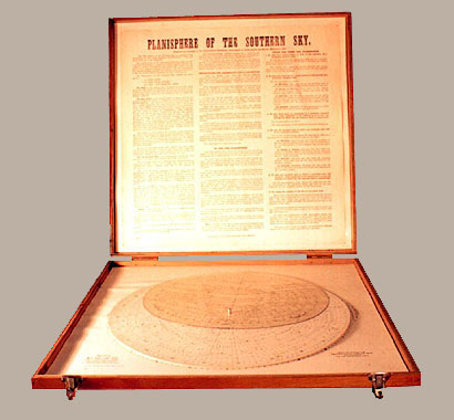
This instrument is basically a map of the southern sky which was compiled from information in the "Star Almanac for Surveyor's" in 1951, and was therefore used as a means of "astronomical navigation" using the stars as reference points. The Planisphere consists of (1) The base, (2) The Star Chart and (3) The Altitude-Azimuth Grid. The star chart is the larger of the two circular disks, as shown in the image, and is marked with a few prominent stars and constellations, and a date scale. The chart is simply made to correspond with the orientation of the night sky, and the time is given against the appropriate date. |
|
History & comments |
This instrument was prepared by direction of the Surveyor-General's Department of Crown Lands and Survey, Melbourne in 1954. |
|
Conservation |
Wooden case |
|
Condition |
Good |
| Remarks |
|
|
Dates |
Manufactured in 1954. Catalogued in 1997 |